A protective array of sensors helps firefighters predict and monitor fires
on October 19, 2011
From a distance, standing on the windy ridge in Las Trampas Regional Park, the space-age contraption surrounded by a chain link fence looks out of place in the middle of swaying grass and a herd of grazing cows. But this array of sensors, hooked up to a central computer, is playing an integral role in protecting this landscape, as part of a network of weather stations that have made a big difference over the last 20 years in monitoring and predicting fire risk in Alameda and Contra Costa counties.
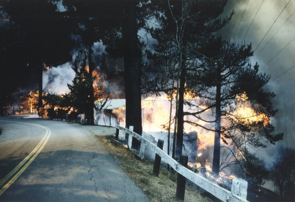
“We can now see patterns and trends that one station wouldn’t really give us, but that the network does provide,” says East Bay Regional Parks Fire Department Assistant Chief John Swanson. “A better understanding of those patterns and trends may have helped us in 1991.”
These Remote Automated Weather Stations (RAWS) represent one of the biggest advancements in fire preparedness since the 1991 Oakland Hills Fire raged through the area now monitored by the new stations. A national RAWS network existed before 1991, but there were no stations in the Bay Area. The Oakland Fire Department now owns two stations, installed in 1994 and 1995. The East Bay Regional Parks District owns four stations, all installed in 1995.
Swanson said the data from this network of stations could have helped predict the surprising behavior of the 1991 fire.
The RAWS have a variety of sensors that collect hourly information on relative humidity, wind speed and direction, solar radiation and rainfall. This data is transmitted to a satellite and relayed to a central processing station, the Weather Information Management System (WIMS) in Kansas City, Kansas, where outputs are generated for all areas of the country. The Oakland and East Bay Regional Parks fire departments use outputs like the Burning Index—a measure of how intense a fire would be that day—and the National Fire Danger Rating (NFDR) system, which ranges from low to extreme risk, to better prepare themselves to respond should a fire ignite.
Parks district fire personnel use these ratings to prepare their equipment and staff ahead of time, so they can respond quickly when a fire does break out, said Swanson. The RAWS data and resulting forecasts help firefighters know what equipment they need to take if they get a call, he said, and what the situation on the ground would look like in case of a fire—how big the flames would be, how fast it would move.
The parks district also uses this data to inform the public when there is a high fire danger day. High danger ratings trigger certain restrictions on park activities, like a moratorium on campfires. Some parks may be closed entirely on an extremely dangerous day—when it’s sunny and hot, the vegetation is dry, and there’s a strong wind: the conditions that caused the 1991 fire to burn uncontrollably.
The three main factors that influence the behavior of a wildland fire are “weather, topography and fuels,” said Swanson. Topography doesn’t change, he said, but fuels can be controlled by proper vegetation management. The RAWS provide the other piece of this puzzle, giving fire departments the weather information they need to be better prepared and predict when a fire might occur.
“The ’91 fire was not an anomaly,” said Swanson, who explained that a wildland fire occurs about every 15 to 23 years. “You a gambling person? Put your money on it. We’ll have another incident.”

1 Comment
Oakland North welcomes comments from our readers, but we ask users to keep all discussion civil and on-topic. Comments post automatically without review from our staff, but we reserve the right to delete material that is libelous, a personal attack, or spam. We request that commenters consistently use the same login name. Comments from the same user posted under multiple aliases may be deleted. Oakland North assumes no liability for comments posted to the site and no endorsement is implied; commenters are solely responsible for their own content.

Oakland North
Oakland North is an online news service produced by students at the UC Berkeley Graduate School of Journalism and covering Oakland, California. Our goals are to improve local coverage, innovate with digital media, and listen to you–about the issues that concern you and the reporting you’d like to see in your community. Please send news tips to: oaklandnorthstaff@gmail.com.

[…] By Brittany Schell and Monica Cruz-Rosas See the original story at OaklandNorth.net […]